Sunday, May 29, 2016
I more or less figured that the 2015-16 season was over. At least until Dylan said he wanted to come visit after classes ended at CSU. He finished up year one of his PhD program in biochemistry and was looking to unwind and hang with family and friends.
At any rate, I made the suggestion that maybe we could go hit the mountain. My original intent was to go up to Mount Hood Meadows, but they closed on May 14 and Dylan got in on the 19th. The good thing was that Mt. Bachelor was scheduled to be open until May 29. Our original plan was to go up on the 21st or 22nd, but the weather didn't cooperate. I didn't have any desire to ski in cloudy and potentially rainy conditions--this time of your (or any time of year for that matter).
Despite crummy weather conditions most of the week, Memorial Day weekend was looking promising. I have a theory, now partially disproven, that it always rains on Memorial Day weekend in Oregon. As I write this, the clouds are gathering in Eugene...so I may still be partially right.
At any rate, we made it happen and it was a pretty cool adventure. At this point in my life I've done a lot of the stuff I'm going to get to do, but we stitched together a program unlike any I've done in my entire skiing career. So...here goes.
Friday, May 27, 2106
Part I: Camping on the Deschutes
First first: combining camping and skiing
I had to work Friday -- class and a thesis defense in the morning, so there was not getting out early. I was initially thinking we would just get up at 4:30 am to get to the mountain by 8am (operating hours this time of year are 8am - 1pm). Diane suggested we just spend the night up near the mountain. I did a little poking around on the web to confirm what I thought would be the case--everything was booked up for the weekend. The cheap places that were left were $200 or more. I'm not willing to spend that kind of money to go to Bend.
Change of plan: camp out Friday night and then ski Saturday. There was some risk that we might not find a place - campgrounds fill up as fast as hotels. But, it's a big forest and we were confident that we could find something. We left around 5pm and headed out Highway 58 towards Willamette Pass, up to the Crescent Cutoff and onto the Cascade Lakes Loop. That loop is one of the most beautiful in the state--and one of the few places in Oregon where you really feel like you are in an alpine area. Unlike the Rockies, we have lots of volcanos that aren't quite as dense.
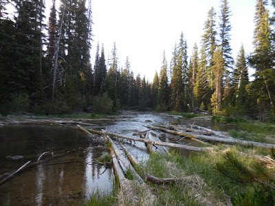
Anyway, after verifying that the campgrounds were full by looping through a few, we detoured off a dirt road that had an angler sign on it. Those signs are a dead giveaway that there is river access. We hoped to find a place by the river. After passing a few sites that were taken, we found a nice unoccupied one near Little Lava Lake and decided it would do--in part because searching more might not lead to a better place.
This one was nicely tucked in the woods.

Not far from the headwaters of the Deschutes River.
We cooked dinner, chatted a while, and then went to bed. It was pretty cold - below freezing -- but not at all unbearable. We got up around 7:20am, broke camp, and hit the road. Batchelor awaited and we wanted to maximize our ski day.
Part II: Mount Bachelor
Saturday, May 28, 2106. 7:45am
Second first: skiing on Memorial Day weekend.
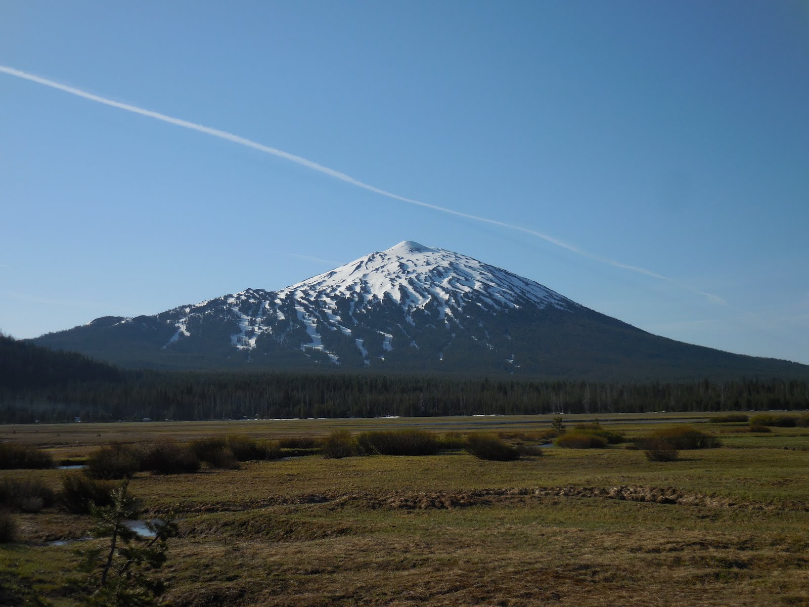
Mount Bachelor from Sparks Lake.

We rolled into the parking lot just before 8 and got ready. We were on the lift by about 8:15am. Conditions were perfect for a late spring day of skiing. The crowd in the parking lot was pretty rowdy so we knew it was going to be a fun day.
Pine Martin lift from the west base.

We headed straight for the summit. It's been a very long time since I've been to the summit of Bachelor--probably 20 years or more. I don't get up there very often, and when I've gone, the weather has been really crappy. Bachelor has a reputation for nasty weather -- some call it Mt. Badweather. That wasn't the case today.
Dylan on the summit looking south.

I've been working on a consulting team on a big project for the City of Bend helping them to sort out their growth boundary and refine their growth management strategies. I made a few friends on the City staff along the way. Not surprisingly, they ski.
Nick Arnis

Interesting thing about Nick - Kayla worked with his brother for a period of time in Steamboat. When I first met him he was always wearing a Steamboat cap, so I started chatting with him about that since we apparently had something in common.
Third first: summiting Mount Bachelor.
A few quick facts about Bachelor.
Mount Bachelor, formerly named Bachelor Butte, is a stratovolcano atop a shield volcano in the Cascade Volcanic Arc and the Cascade Range of central Oregon. The Mount Bachelor ski area has operated on the mountain since 1958.
- Elevation:
- Last eruption:
Last eruption 8000 years ago; nothing like
dancing on a volcano.
We hiked up to the summit on the second run. Nieghter Dylan nor I have ever been to the summit so we immediately agreed with Nick's suggest to hike up there. It's a pretty easy 10-minute walk from the summit chair - and the bowls off the top look amazing.
Fourth first: skiing the chutes at Bachelor
Honestly, I've always had a pretty low opinion of Mt. Bachelor. Most of the lower runs are fun, but not very challenging and...well, the weather is always crappy. I will confess that today significantly changed my view. The three chutes off the summit are sustained 50 degree pitches for about 1000 vertical feet and all drop into the cirque.
Dylan gets his stoke on at the summit.

Nick.

Prepping to drop in to Chute 2.

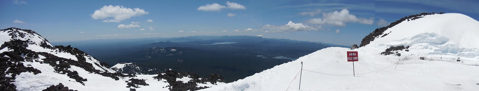
The view from the summit is stunning.
I.

II.

Dylan shredding Chute 3. Note the avalanche sluff at the bottom. A chunk of the cornice broke off and slid at some point in the recent past. It's much steeper than it looks.

Dylan skirts the palisades in Chute 2.

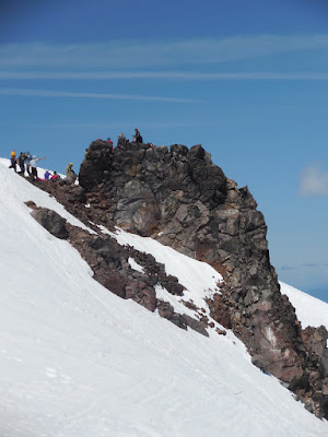
Around 11 a party broke out on the palisades. We didn't join in, but it looked like fun. Not as much fun as skiing. The perspective gives a sense of the steepness, but it gets quite a bit steeper just below.
Chute 1.

Dylan up to his typical antics of hopping rocks.

Panorama from the Cirque.

Dylan tears up Diane's board.

Panorama looking south from the summit.

Beverly Hills...that's where I want to be.

We wrapped up right around 1. It was getting pretty sticky and it was time for food. We packed up and went down into Bend and grabbed some Thai food from a food cart. The crowds in town were substantial.
Part III: Oregon Badlands Wilderness
Saturday, May 28, 2106. 3:00pm
Fifth first: hiking the Oregon Badlands
From snow to desert in less than an hour.
Since skiing ended early, we decided that a hike might be useful. We talked about going out to the Crack in the Ground, but that was probably a good two-hour drive. We also talked about Mirror Lake in the Sister's Wilderness, but ultimately decided on the Oregon Badlands.
The Badlands are about 20 miles east of Bend and were designated a wilderness area in 2009 - relatively recently and somewhat amazing given Congress' inability to do much of anything. The area is about 30,000 acres of desert. Our destination was Flatiron Rock and Badlands Rock.
The Oregon Badlands

Entrance from the trailhead.

It must be spring, flowers are blooming. It's pretty amazing that 30 miles east of Bachelor, which got nearly 500" of snow last season, it turns into desert.
The trail wasn't very inspiring--just an old jeep track through the desert.

It was a good four miles to the first destination - Flatiron Rock. What we encountered was pretty amazing from a geologic perspective. Here's a summary of the geology of the area.
The wilderness is situated on high desert terrain and is associated with a volcanic rootless shield. This broad 10-to-12-kilometre (6.2 to 7.5 mi) volcanic shield issued lava from a rootless vent. The lava flow dates to about 80,000 years old and comes from a main vent further up the slopes of Newberry Volcano. This main vent was located near Lava Top Butte and the lava that came out of this vent traveled through the Arnold Lava Tube System to arrive at the current location of the Badlands. An irregularly-shaped pit crater at the top of the shield marks the site where lava flowed in all directions to create the Badlands. Lava tubes acted as conduits for the lava in some instances and are evidenced on the surface by tumuli, also known as pressure ridges. Soils in the Badlands were largely formed from ash associated with the eruption of Mount Mazama some 7,700 years ago.
A bit of interpretation here. Mount Mazama is more generally known as Crater Lake. Newberry and the Arnold Lava Tube are about 30 miles southwest of these formations. We were wondering what the geologic processes were that formed these amazing rocks. One of the most remarkable things is that they are continuous in a roughly triangular or rectangular shape. Walking through the pressure ridges was amazing.
The site is a little like Crack in the Ground down by Christmas Valley, but different in the sense that they are not linear and not as deep.
Aerial view of Flatiron Rock.

Flatiron Rock

The view looking east.

Three Sisters from the top of Flatiron Rock. The formation on the left is Broken Top.

Mt. Hood

Victory is ours!

Lichen at Flatiron Rock

Arch formation

We then hit the trail towards Badlands Rock.

Badlands Rock was even cooler that Flatiron in some respects. The ridges were deeper and there were lots of cracks to explore.

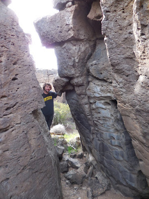
Dylan peeks through one of the cracks.
Things are looking up.

The ridges are a good 25-30' high.

It was getting late so we hoofed it back to the car. Dylan pointed this out when we left. I'm not sure what the exact explanation is, but am open to theories.

All in all, a very fun day of skiing and adventuring. We got home around 8:30 and were beat. What a great way to end the 2015-16 ski season!